|
Coast Range Tour
1. The
natural environment
2. Humans
in the Coast Range
The natural environment
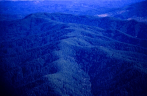 |
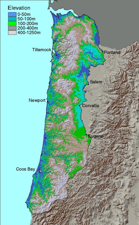
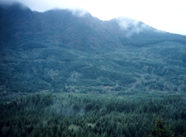
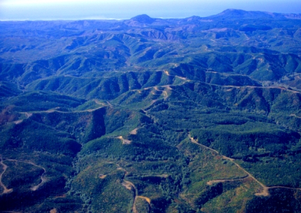
The Coast Range is a major topographic
and climatic divide in the Pacific Northwest region. Its
mountains are rugged with sharp ridges and steep slopes.
Elevations range from 450 to 750 meters (1500-2500 feet)
in main ridge summits, with a high of 1,249 meters (4097
feet) on Marys Peak. |
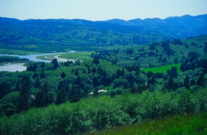
| Rugged terrain gives way along the coast
and major rivers to undulating hills and flat valleys
where dairy farming is common. The mountain slopes are
typically a mosaic of young forests of different ages,
reflecting the recent historic pattern of forest management. |
|
 |
The Coast Range climate is characterized
by mild temperatures, a long frost-free season, prolonged
cloudy periods, narrow seasonal and daily temperature
fluctuations, mild wet winters, cool dry summers, and
heavy precipitation mostly falling from October to March.
The highest precipitation occurs along the interior mountain
range, while the driest areas are near the Willamette
valley. |
| The Coast Range is among the most productive
forest ecosystems in the world, more productive even than
many tropical forests. It has the capacity to produce
huge quantities of wood, but also produces large quantities
of non-timber vegetation, wildlife, and fish, all of which
depend on the same underlying factors: mild climate, abundant
rainfall, and deep soils. |
 |
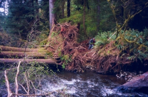 |
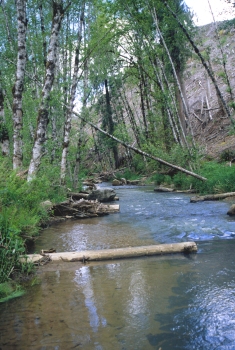
Streams in the Coast Range have historically
contained large fallen trees, which created crucial habitat
for salmonids and other aquatic vertebrates and invertebrates. |
In contrast to the productivity of forest
lands, the net primary productivity of streams in the Coast
Range is relatively low, possibly because high forest productivity
means relatively little sunlight reaches the water - less
than five percent of full sunlight in some cases. However,
coast range watersheds have the potential to produce large
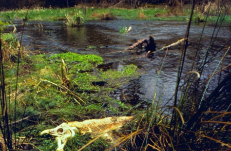
amounts of fish biomass as a result of anadromous fish runs.
When these fish, particularly salmon, made their way into
coastal streams in the past, they ended up as carcasses
on the shore, providing a source of food and nutrients for
predators, scavengers, and the ecosystem as a whole.
| While the Coast Range is an ideal region
to grow trees for timber, it is also ideal for species
that use large live and dead trees, and their associated
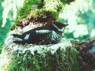
stream reaches, for habitat. Endangered species such as
the marbled murrelet, the northern spotted owl, and the
coho salmon have inhabited the province for millennia.
|
 |
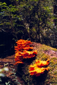 |
Large dead wood has several functions
in Coast Range forest ecosystems, including: fixation
of nitrogen; storage of carbon and water; development
of soil structure; habitat for cavity-nesting and forest
floor vertebrates; and habitat for invertebrates, plants,
and fungi. |
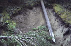
| Disturbances come in many shapes and
sizes in the Coast Range, all integral to the productivity
and biological diversity of ecosystems. Landslides open
gaps in dense forest and expose mineral soils, which may
be important to maintaining some deciduous shrub and tree
species. Landslides also feed large and small materials
into both headwater and mainstem streams, affecting stream
function and productivity. |
 |
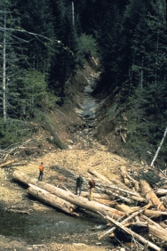 |
Floods have always played a dramatic
and integral role in shaping streams and riparian zones
in the Coast Range. They can initiate landslides on slopes
that move large and small materials into streams, and
open up forest gaps. In streams, they scour stream beds,
move large amounts of coarse woody debris, carry fine
sediments, rearrange stream profiles, and open up the
forest canopy to allow higher levels of sunlight to reach
the water. |
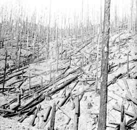
Until the advent of large-scale logging
and effective fire suppression in the middle of the 20th
century, wildfires were the dominant disturbance in Coast
Range forests. Before Euroamerican settlement, fire return
intervals ranged from 90 to 400 years, with severity ranging
from light to severe (>70% of canopy trees killed). In
its natural state, the Coast Range would have been a slowly
shifting mosaic of large and small patches of forest, ranging
from shrubby areas to dense old forests.
Humans in the Coast
Range
Return to top
 |
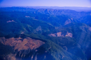
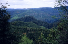
Current forest patterns result primarily
from wildfires and historic and present-day logging.
Virtually all forest lands in the Coast Range in private
ownership have been harvested at least once in the past
and are less than 80 years old.
|
| Many National Forest landscapes retain
the patterns created by two decades of staggering small
harvest units across the landscape and harvesting them
at a constant rate. Many BLM lands have a similar mosaic
of clear cuts, but also frequently appear as a checkerboard
of older forests mixed with young forests on the surrounding
private lands. Logging of older forest on federal lands
was drastically curtailed after listing of the northern
spotted owl as a Threatened species under the Endangered
Species Act. |
 |
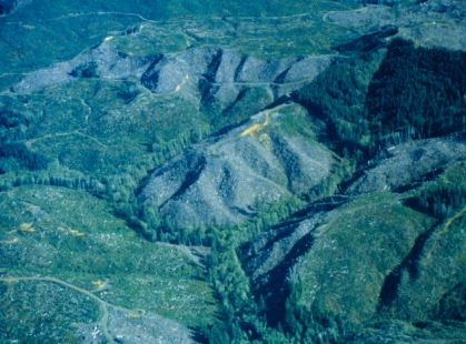
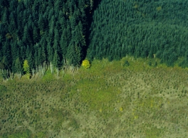
Private industrial landowners seeking maximum
financial returns on their lands use intensive management
methods that include clearcutting most live trees and snags,
preparing sites with fire or herbicides, replanting with
a single species (usually Douglas-fir), periodic thinning
to maintain vigorous and evenly spaced crop trees, and harvesting
at 40- to 70-year intervals. Clearcut units on these lands
tend to be larger than on federal or state lands, with 120
acres the current maximum allowed under the State Forest
Practices Act.
 |
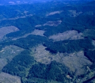
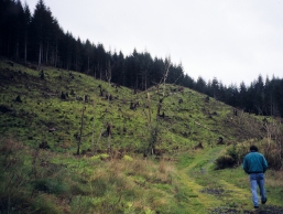
Another view of private industrial lands. |
| Forests on non-industrial private lands
reflect the distribution of parcels of individual landowners,
which are typically much smaller than industrial or federal
lands. These lands are often found along streams, are
usually less intensively managed for timber than industrial
lands, and utilize partial harvesting more often. |
 |
 |
State lands are generally intermediate
in management intensity between private industrial and
federal lands. Less than 10 percent of the coastal province
is State-owned, with the Tillamook and Elliott State Forests
being the predominant holdings. State forest management
plans and practices are changing to reflect societal concerns
about biodiversity. |
Forest roads have served numerous functions,
including access for extraction of wood and other forest
products, silvicultural activities, fire detection and suppression,
and recreation. Unintended negative impacts have included
effects on water runoff, erosion and effects on fish habitat,
landslide initiation, invasion of exotic species and pathogens,
and wildlife dispersions due to collisions or hunting. Although
roads commonly occupy less than four percent of the area
of a forest landscape, their effects can be more widespread.
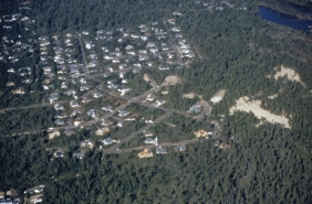 |
Forests and farmland in the Coast Range
have historically been subject to development, either
low-density residential or sometimes urban. Although Oregon’s
land use planning program attempts to concentrate development
within urban growth boundaries, its success remains uncertain. |
| Leaving riparian buffers along streams
is now a common approach to protecting aquatic habitat.
However, many questions remain about how wide those buffers
should be, how they should be managed, and how they should
be distributed across a watershed. |
 |
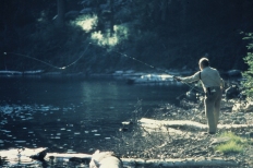 |
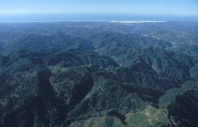
Recreational uses of the coastal province
are important to the economy and social well-being of
Oregon. The Coast Range, coastal valleys, and beaches
have long attracted visitors to their mix of fishing,
hunting, hiking, birdwatching, beachcombing, cycling,
camping and RV use. Decisions affecting road closures
and forest and wildlife management will have impacts on
recreation opportunities. |
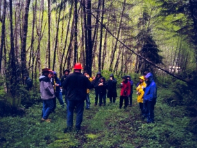
| Community involvement in land use issues
has steadily increased over the last several decades as
forest management controversies have become more intense.
Watershed Councils are examples of collaborative efforts
to reach watershed goals with greater public input. |
 |
|