|
Projecting landscape
conditions in the Coast Range with the CLAMS simulation model
Pete Bettinger, Department of
Forest Resources, Oregon State University
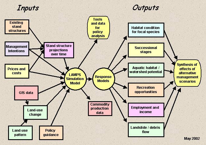
Objective
Build and apply dynamic, spatial models that simulate forested
landscapes, the condition of fish and wildlife within these
landscapes, and the economic and social outcomes and outputs
they will produce.
Main points
- We are working with
the major landowners in the Coast Range in an effort to
simulate their management intentions in a reasonable manner.
- The CLAMS simulation
model is a spatial simulation model and is associated with
a quantitative projection of stand structures.
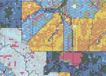 |
Spatial decision units
- Pixels
- Basic simulation units (aggregations
of similar, contiguous pixels)
- Parcels (harvest units)
- Harvest blocks (aggregations
of parcels)
|
|
|
Modeling landowner behavior
|
OWNER
|
HARVEST PRIORITY
|
SILVICULTURAL CHOICES
|
SPATIAL DECISION UNIT
|
|
Forest industry
|
Value-based
|
Clearcut
Rotation age
|
Parcel
|
|
Non-industrial private
|
Age-based
|
Partial cut
Clearcut
|
BSU
|
|
Federal
|
Structural
stage-based
|
Thinning
Clearcut (Matrix)
|
Parcel
|
|
State
|
Structural
stage-based
|
Complex
|
Parcel
|
|
 |
Stand structure projections
(forest growth models)
ORGANON for private and state management prescriptions.
ZELIG for federal management prescriptions.
|
|
|
Inputs to the models
|
Stand structure
data
Volume
Value
Vegetation class
Age
Snags
Down log volume
Canopy closure
Average overstory tree diameter
Trees > 40 inches dbh
|
GIS data
Ownership
Ecoregion
Initial vegetation class
Distance from stream
Slope class
Watershed
Acres
Whether the BSU is "forest" or "non-forest"
|
|
|
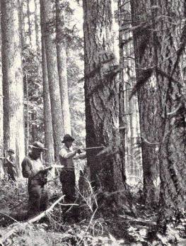
Clearcut size limits
Parcels which are clearcut in the same planning
period, and next to each other, are aggregated,
and the total aggregate size of these areas is
limited to 120 acres.
We also attempt to produce a distribution of
clearcut sizes similar to recent history.
|
 |
|
Simulation scheduling considerations
- Federal
Schedule thinning volumes when they can occur in reserves.
In matrix areas, randomly select harvest units for clearcut
harvest: no more than 1% of matrix land in each 5th-field
watershed (5,000-50,000 acres) can be clearcut in any one
year; older forest must be maintained above 15% of federal
land in each watershed.
- State
Randomly select harvest units for treatment, based on a
goal of achieving a distribution of structural size classes
within each 5th-field watershed (5,000-50,000 acres). State
riparian rules are modeled.
- Non-industrial private
Use harvest probability approach, which is based on stand
age over time, to schedule either partial cut or clearcut
treatments. State riparian rules are modeled.
- Forest industry
Use a binary search technique to achieve an even-flow of
harvest volume over time. Harvest units are "blocked"
for clearcut treatments. Block sizes are determined based
on an estimate of recent clearcut size distributions in
the mega-sheds. State riparian rules are modeled.
- Other considerations
For any BSU that is assigned a clearcut treatment:
The assignment subsequent prescriptions utilizes a "transition
probability" to determine which vegetation class each
BSU becomes after clearcut. The probabilities are based
on: ownership class, ecoregion, vegetation class prior to
cutting, and distance to the stream network.
In each period, 1% of the hardwood BSUs, on the lowest slope
classes, within 100 feet of the stream, are re-established.
Riparian management prescriptions are timed with clearcuts
in the uplands in the same parcel. These prescriptions are
an attempt to model the State Forest Practices Act riparian
rules.
Conclusions
The CLAMS simulation model was developed
with the intent that it will be used for forest policy analysis.
We want to use this spatial simulation
model to help people think through forest policies before
adopting them.
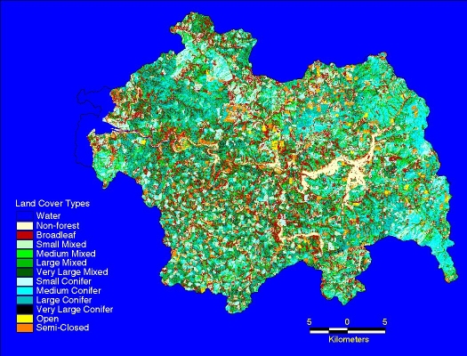
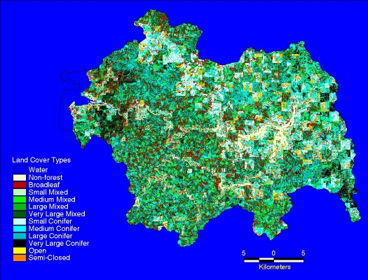
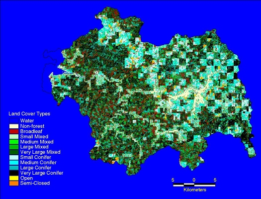
DRAFT projections - Alsea Basin, OR
Year 1995
Year 2045
Year 2095
|