


Wet Weather Creek RNA
 |
 |
 |
|
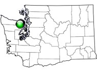
Wet Weather Creek Research Natural Area (RNA) was established to represent a Douglas-fir (Pseudotsuga)/western hemlock (Tsuga heterophylla) forest type on east side slopes of the Olympic Peninsula in addition to a subalpine fir (Abies lasiocarpa) forest in the northwestern portion of the peninsula. The RNA lies in the headwaters of Big Quilcene River in the eastern portion of the Olympic Peninsula. There are subalpine ridges on the northern boundary and a forested valley of Wet Weather Creek. The topography ranges from moderate to very steep slopes. Western hemlock/rhododendron - salal (Gaultheria shallon) plant communities with doghair stands and rocky balds dominate the lower Wet Weather Creek. Lodgepole pine (Pinus contorta) is also present. Subalpine fir/common juniper (Juniperus communis) and subalpine fir/rhododendron communities dominate higher elevations while subalpine fir/krummholz and subalpine/cushion plant communities dominate ridge tops. Olympic violet (Viola flettii) and blunt sedge (Carex obtusata) are narrow endemic and sensitive species plants within the RNA, respectively.
| Records and Plans: | |
| Research Publications Associated with this RNA: |