The Island PRNA
| Name: |
The Island |
| Ownership: |
FS |
| Type: |
PRNA |
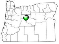
| State: |
Oregon |
| Ecoregion: |
Blue Mountains |
| Forest: |
Ochoco NF |
| District |
Crooked River National Grassland |
| Acres: |
82 |
|
View with Google Maps
|
The Island Research Natural Area (pRNA) was selected to represent western juniper/big sagebrush/bluebunch wheatgrass (Juniperus occidentalis/Artemisia tridentata/Pseudoroegneria spicata) and western juniper/big sagebrush/antelope bitterbrush/bluebunch wheatgrass (Juniperus occidentalis/Artemisia tridentata-Purshia tridentata/Pseudoroegneria spicata) plant associations in central Oregon. The pRNA is located on a mesa isolated by steep cliffs and talus slopes just south of the confluence of the Deschutes and Crooked Rivers. The topography is flat and without drainages or surface water.
| Records and Plans: |
|
| Research Publications Associated with this RNA: |
- Vegetation change and the role of atmospheric CO2 enrichment on a relict site in central Oregon: 1960-1994; Knapp, Paul A.; Soulé, Peter T. 1996
- Post-drought growth responses of western juniper (Juniperus occidentalis var. occidentalis) in central Oregon; Knapp, Paul A.; Soulé, Peter T.; Grissino-Mayer, Henri D. 2001
- Climatic regionalization and the spatio-temporal occurrence of extreme single-year drought events (1500-1998) in the interior Pacific Northwest, USA; Knapp, Paul A.; Grissino-Mayer, Henri D.; Soulé, Peter T. 2002
- A time comparison study of vegetation on The Island Research Natural Area in central Oregon; Fox, M. Anne; Eddleman, Lee E. 2003
- A relict area in the Central Oregon Juniper zone; Driscoll, R. S. 1964
|


