


Pipe Fork RNA
 |
|
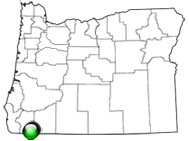
Pipe Fork Research Natural Area (RNA) was established to represent Port Orford cedar (Cupressus lawsoniana) in Josephine County. The topography is steep and highly erodible with granitic soils. The Pipe Fork Creek watershed drains northeast into Williams Creek. The channel contains coarse woody debris along with other evidence of flooding. Port Orford cedar and occasional stands of Douglas-fir (Pseudotsuga menziesii) dominate the RNA. Salal (Gaultheria shallon) understory is common in the riparian zones while dwarf Oregon grape (Berberis nervosa) and twinflower (Linnaea borealis) are common in the upland community.
| Records and Plans: | |
| Research Publications Associated with this RNA: |