The Geomorphic Response of Rivers to Dams: Geologic Overview- The Clackamas Basin
Back to the PEP Index .:. Other presentations included in this collection
 Presenter: Peter Wampler
Length: 2 Parts
Topics:
Part 1
- Introduction
- Western United States DEM
- Oregon DEM
- DEM of Northwest Oregon - Willemette Basin
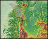
- Shaded Relief of the Clackamas Basin
- Simplified Geology Map - Colored
- On Top of the Cascades
- Cascade Mountains
- The Techtonic Evolution of the West Coast
- Shaded Relief - Moving down
- High Cascades
Part 2
- Lava Flow Near South Sister
- Cascade Range Volcanoes
- Cascade Eruptions During the Past 4000 Years
- Shaded Relief
- Western Cascades
- Large Boulder from the Sardine Formation
- Simplified Tectonic Model of the Willamette Valley
- Simplified Tectonic Model - Juan de Fuca
- Simplified Tectonic Model - Further subduction
- Simplified Tectonic Model - Docking
- Simplified Tectonic Model - Willamette Valley
- Shaded Relief Map||The Willamette Valley Province
- Geology of the Lower Clackamas BasinThe Missoula (Bretz) Floods
- Glaciers - Glacial Dams - Jokulhlaps
- Glacial Erratics in the Willamette Valley
- Erratic State Park in McMinnville
- Pre-Flood
- WSE ~ 150 feet
- WSE ~ 200 feet
- WSE ~ 250 feet
- WSE ~ 380 feet
- Geology of the Lower Clackamas Basin
- Profile Across Lower Clackamas River Valley
- Estacada Terrace
These presentations were produced by Michael J. Furniss and Jeff Guntle, of the US Forest Service, PNW and PSW Research Stations.
 US Forest Service,
  Pacific Northwest Research Station,
  Pacific Southwest Research Station,
  Stream Systems Technology Center