Site Info


Site Info |
|
The Site Information Window allows you enter and save additional information about the crossing. This information is optional and not used for calculations, but is available as output in a Culvert Report.
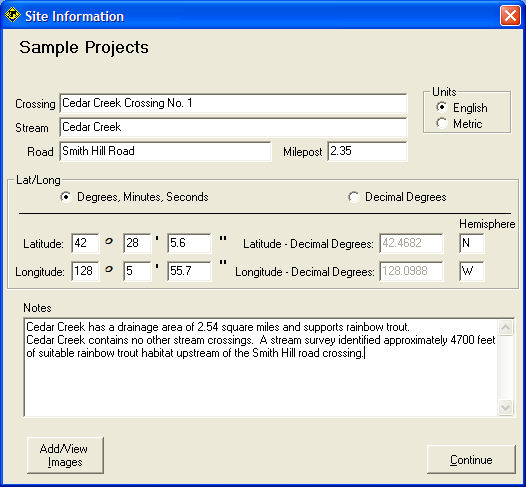
Crossing / Stream / Road / Milepost
Descriptive identifiers about the crossing site and adjacent landmarks. Mile post will change to Kilopost if metric units are used.
Units
Selecting units on the Site Information window will determine the units used for data entered on the Crossing Input Window.
Lat/Long
Latitude and Longitude can be entered in Degrees, Minutes, Seconds or in Decimal Degrees.
Notes
Enter any text you like that further describes the site.
Continue
Continue to the Crossing Input Window.
Add/View Images
Note: Images are linked to the crossing description, they are not actually saved with the FishXing (.xng) file. If you move the pictures from their original location you will need to point FishXing to their new location.
![]() FishXing Version 3.0 Beta, 2006
FishXing Version 3.0 Beta, 2006