
 Kazakhstan
53.10°N 65.97°E
Kazakhstan
53.10°N 65.97°E
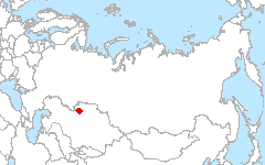
Kazakhstan, central part of Kostanay Region (Kostanayskaia oblast).
Investigators
- Alexey Terekhov - Almaty, Kazakhstan, National Center of Space Research and Technologies
Site Description
The area belongs to Western Siberian climatic province of temperate zone with sharply continental climate. The geographic province is Northern Turgai, which belongs to steppe and dry steppe zones. The terrain is largely flat, with several plateaus ranging in altitude between 250 and 320 meters above the sea level and the wide (30-50 km) bottom of the Turgai valley, which has minimal altitude of 120-125 meters above the sea level. During the last glaciation the intense erosion resulted in wind-blown sand deposition in the middle of Turgai valley where sand dunes and lakes were formed.
The climate of the region is distinctly continental, with hot and dry summers, and cold winters with little snow. Average January temperatures are –17-18°С; July averages are +19°C +24°С. The highest temperature on record is +42°C, while the coldest on record is -45°C. Spring and autumn last about 30 days each. It usually gets above freezing during the first week of April, and gets below freezing during the last week of October. The summer is hot and dry; the winter is cold, without much snow. Average annual temperature is +2.4°C.
The stream network functions only seasonally, primarily in spring, flowing from the plateaus to Turgai valley. The largest east-flowing rivers are Dana-Bike (58 kilometers long) and Naurzum-karasu (85 kilometers long); they have well-defined basins which are very deep in the upper reaches. When the snow melts, the water fills up the basins, and upon reaching the lakes, spreads out, flooding the lowlands. Most of the measured annual water flow is quite uneven, with 90% of it belonging to spring run-off on the big rivers and virtually all - on small rivers. The duration and intensity of run-off on small seasonal streams varies year-to-year.
Land Cover

Click for larger image
Download
- Site Report (2.0 MB - PDF)
- Land Cover (preview - 370kB,png) (data - 2.6MB, geoTiff.zip)
- Source Landsat imagery available via LARSE Image Database
Global Map Analysis
Comparison of dominant life form types
Publications
- Terekhov A.G., et al. (in preparation). Diagnostic of ground humidity of steppe zone in Northern Kazakhstan during 1988-2007 years on base of LANDSATand NOAA/AVHRR data. Planned for submission to the book ”Modern problems of remote sensing of Earth from space” [rus], 2010.
- Terekhov A., Krankina O. (in preparation). Algorithm of Quick Bird imagery classification in task of estimation of tree cover density. Planned for submission to the J. Computer Optic [rus]