 Global Land Cover
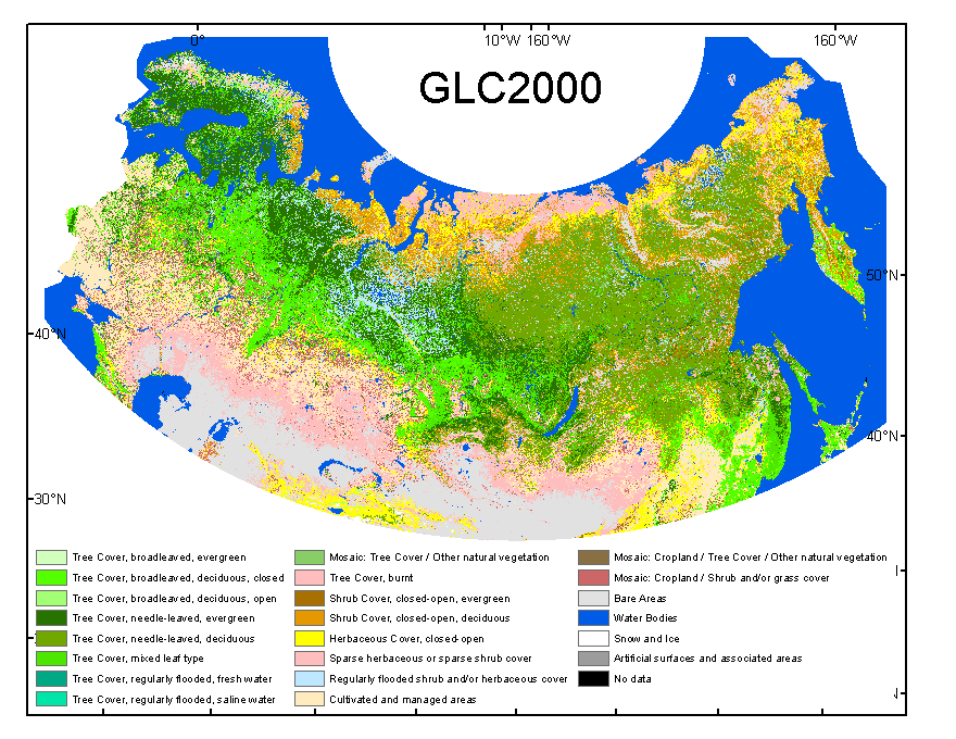
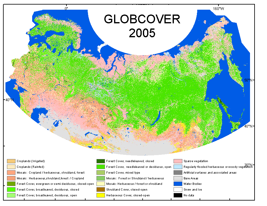
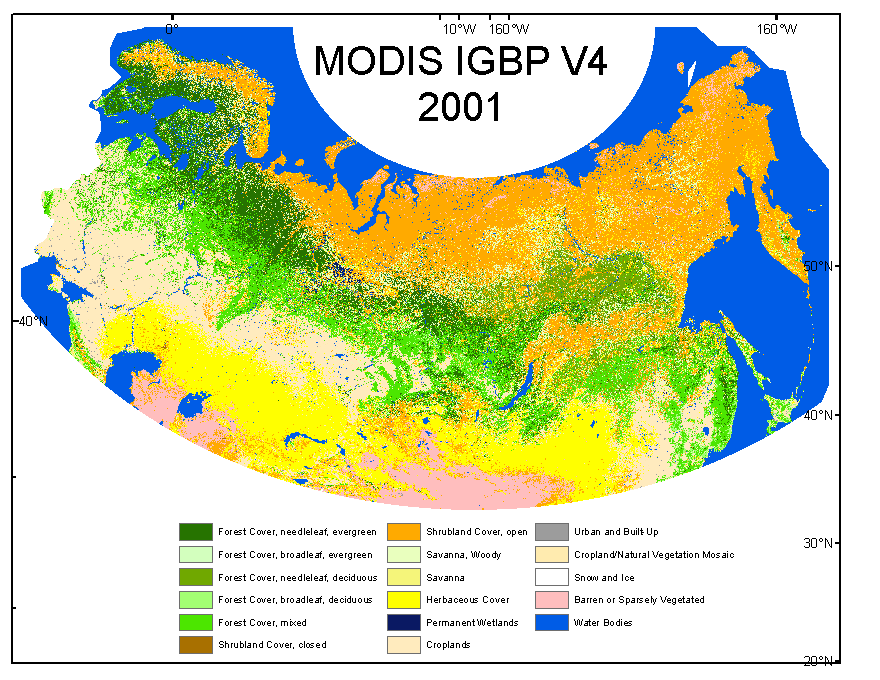
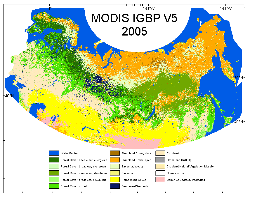
To identify specific needs and possibilities for improved mapping of land cover across boreal and temperate Northern Eurasia, we compared the performance of recent land-cover products derived from different sensors: MODIS (MODIS IGBP Land Cover Collection 4 and 5), SPOT VEGETATION (GLC-2000) and MERIS (GLOBCOVER)
What are the differences and similarities between global datasets?
We examined the level of agreement among these data sets across the entire region. On a qualitative level, the assessment of general patterns indicates the highest degree of disagreement in transitional zones at the northern and southern fringes of boreal forest, in mountainous regions, and in areas of extensive wetlands, agricultural development, and urban land use. The quantitative analysis measured the level of disagreement between land-cover classes aggregated according to dominant life form type of vegetation (trees, shrubs, herbaceous, bare land, and permanent snow/ice).
What is the accuracy of global maps at NELDA test sites?
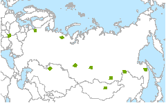
Validation of global datasets was performed with higher resolution, Landsat-based land cover maps from NELDA test sites. Fractional land cover was calculated for coarse resolution pixel and used to construct fractional error matrices. Most errors were associated with “mixed” coarse-resolution pixels (i.e. those having nearly equal percentage of multiple class types), while errors in “pure” (single class) pixels were low. In addition to actual differences in land-cover classifications, other sources of discrepancy among these land cover products include class definitions, map projections, and spatial resolution.
Dominant Live Form Types
Differences in class definitions and legends between maps are a major difficulty for comparing global land cover data sets. We converted each legend to a standard classification on the basis of the dominant live form types (LFT): tree, shrub, herbaceous and barren/sparse vegetation and water. Classes representing mixtures of vegetation types were labeled as 'mosaic'. Select a site on the left menu to compare LFT maps derived from global land cover datasets with Landsat-based reference maps.
Global Land Cover Data for Northern Eurasia