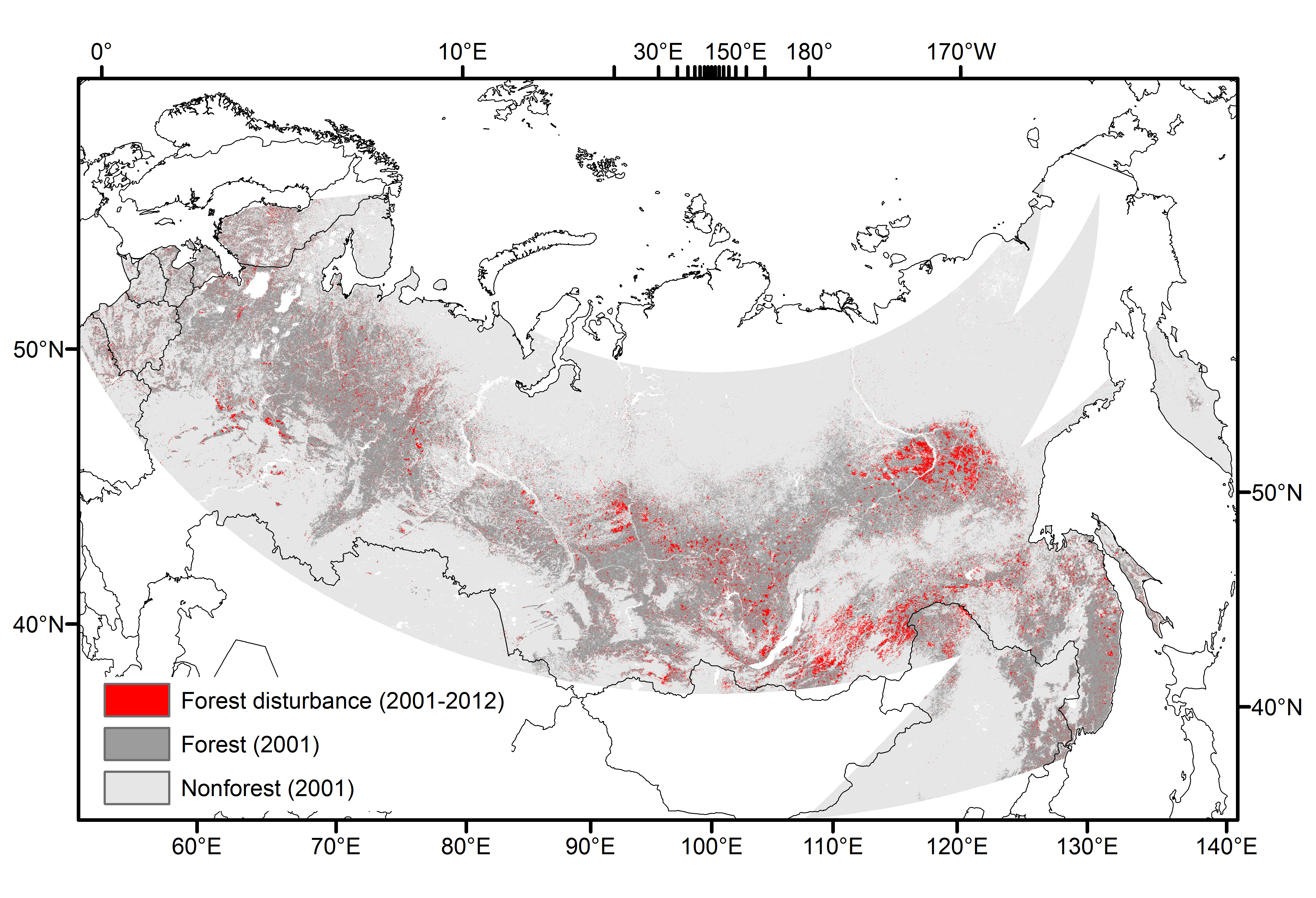
MODTrendr forest disturbance map
To map forest disturbances for the region of Northern Eurasia, we we overlaid the MODTrendr disturbance map on the MODIS IGBP land cover map from 2001 (Collection 5.1) to mask out changes in non-forest land covers. The resulting map is hereafter referred to as the MODTrendr forest disturbance map.

MODTrendr map of forest disturbances (dNBR>0.02) between 2001 and 2012 over Northern Eurasia. The forest classification is based on the C5.1 MODIS IGBP map from 2001 and represents the following classes: evergreen needleleaf forest, deciduous needleleaf forest, deciduous broadleaf forest, and mixed forest.
Overall, 11.3% of the forest pixels were disturbed between 2001 and 2012. Deciduous needleleaf forest showed the highest disturbance proportion (15.5%), followed by evergreen needleleaf forests (12%) and mixed forests (10.1%). Deciduous broadleaf forests showed the lowest disturbance proportion (6%).

Credit:
- D. Pflugmacher, D. Sulla-Menashe, O. Krankina. “ASSESSMENT OF THE MODTRENDR ALGORITHM FOR MAPPING FOREST DISTURBANCES IN NORTHERN EURASIA” NELDA-II REPORT (UNPUBLISHED)
